Item Detail
Warnings and disclaimer
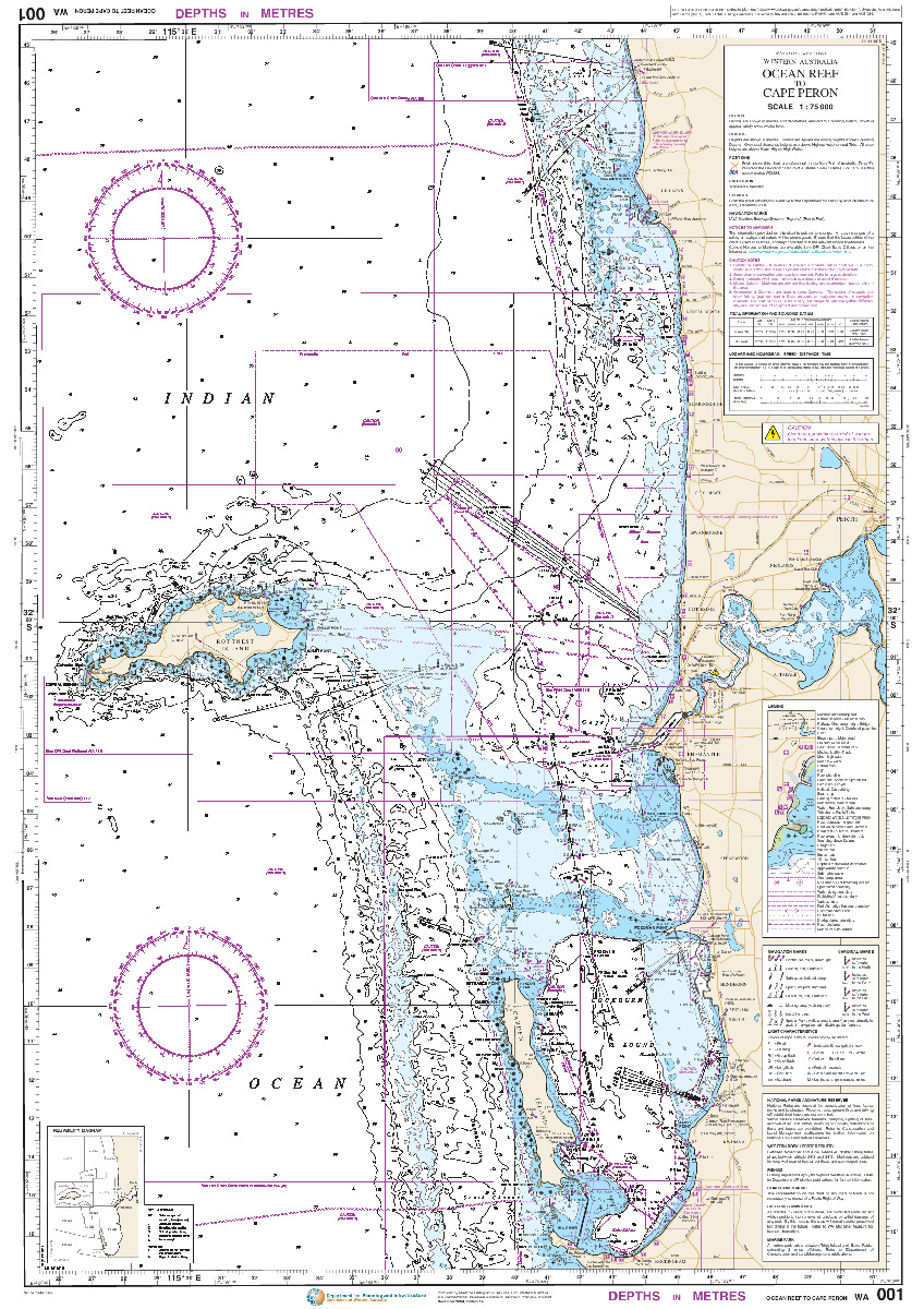
These two maps were originally printed back-to-back. Includes nautical charts of Fremantle Boat Harbours, Jervois Bay Boat Harbours, Ocean Reef Boat Harbour, Hillarys Boat Harbour. Maps include tidal information and sounding datum, reliability diagram, metropolitan exempt area. Standard map series designation: WA 001.
Subjects
Links & Sharing
Order a Copy
Copies of items can be ordered from the State Library collections for personal use, research, or public display and publication. Copyright and other restrictions may apply. For more information about this service please visit the State Library website.
Contribute
Can you provide any additional information about this item, or do you have any general feedback about the new State Library online media viewer? Please let us know using the form below.
Info & Help
You are using the State Library of Western Australia online media viewer. Use this app to view digitised items within the State Library catalogue.
Desktop keyboard shortcuts
| Key | Behaviour |
|---|---|
| i | show detail about this item |
| l | show linking and sharing options |
| o | show information about ordering a copy of this item |
| c | show contribution form |
| h | show help panel (this panel) |
| x | close side panel |