Item Detail
Summary
Battye accession number 002798.
Year
[ca. 1930]
Warnings and disclaimer
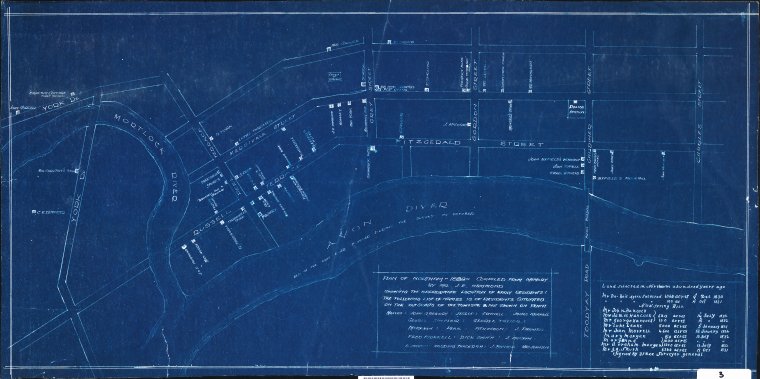
Map compiled from memory by the author. Blueprint map of Northam townsite in 1889, showing the approximate location of early residents and businesses, and roads (named). Includes list of residents situated on the outskirts of the townsite and not shown on plan, table of land selected in Northam, 1830-1836 (10 persons)
Subjects
Links & Sharing
Order a Copy
Copies of items can be ordered from the State Library collections for personal use, research, or public display and publication. Copyright and other restrictions may apply. For more information about this service please visit the State Library website.
Contribute
Can you provide any additional information about this item, or do you have any general feedback about the new State Library online media viewer? Please let us know using the form below.
Info & Help
You are using the State Library of Western Australia online media viewer. Use this app to view digitised items within the State Library catalogue.
Desktop keyboard shortcuts
| Key | Behaviour |
|---|---|
| i | show detail about this item |
| l | show linking and sharing options |
| o | show information about ordering a copy of this item |
| c | show contribution form |
| h | show help panel (this panel) |
| x | close side panel |