Item Detail
Summary
Formerly 930C/1.Rare.
Year
1874.
Warnings and disclaimer
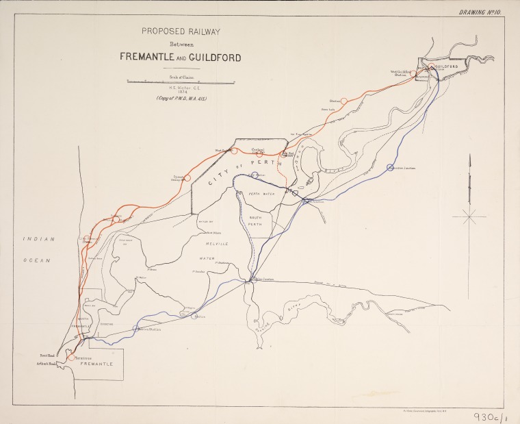
Map show possible routes north and south of Swan River with spurs up South Perth foreshore to Perth and loop across Causeway and branch joining main line at East Perth and branch lines from Canning Bridge along Canning River and from Causeway to Albany. Drawing no. 10. Prepared for a Select Committee of the Legislative Council and for inclusion in despatches to the Secretary of State for the Colonies.
Subjects
Links & Sharing
Order a Copy
Copies of items can be ordered from the State Library collections for personal use, research, or public display and publication. Copyright and other restrictions may apply. For more information about this service please visit the State Library website.
Contribute
Can you provide any additional information about this item, or do you have any general feedback about the new State Library online media viewer? Please let us know using the form below.
Info & Help
You are using the State Library of Western Australia online media viewer. Use this app to view digitised items within the State Library catalogue.
Desktop keyboard shortcuts
| Key | Behaviour |
|---|---|
| i | show detail about this item |
| l | show linking and sharing options |
| o | show information about ordering a copy of this item |
| c | show contribution form |
| h | show help panel (this panel) |
| x | close side panel |